 Hike #65 – Reavis Canyon North – 22 Miles
Location : Reavis Canyon Trailhead (NOBO Mile Marker 310.7)
Date: 12-18-2018
Weather: Clear skies, no clouds, starting temperature 36 degrees and the turn 70 degrees.
Total Mileage Completed : 22 on AZT
Hike Description: This hike started at mile marker 310 at the very remote Reavis Canyon Trailhead – Elevation 2911 ft and was a 22 mile out and back “Flip Flop” hike. Elevation gain / loss 4033 ft.
Comments: So….. Once again without a 4×4 you might have a little trouble (ok a lot of trouble) getting to this trailhead. Somehow I had to safely get to the 22 mile middle section between Hike #12 and the future Hike #82. On this morning there was a good amount of bumping driving and at a couple sections of the dirt road leading to the Trailhead, it was a scramble for the Jeep. Fortunately it was a level terrain and no risk of rolling. Just 4 wheel low gunning it.
And…..guess what…. this it was another Flip Flop. The trailhead, on Happy Camp Canyon Road, was in the center of a 6 mile small OB section I needed to complete from Hike #12 and the northern part was to push into the Superstition Mountains via Reavis Canyon.
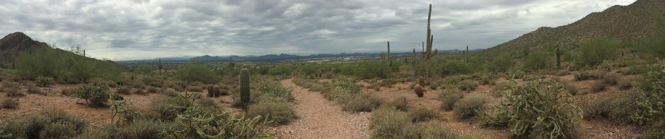
This was going to be a tough day but fortunately the big climb pretty much started right  away. Always easier to hit it while your fresh and the legs in gear. So still in the dark with headlamps on, up up up we went. Thru the canyon and up the side then over the top, Tom and I went. It’s funny when you’re hiking into a canyon with no visible way out but up. You just resign yourself to the fate and wonder where the saddle is. Once on top (it’s a tough climb – 1837ft, 13.4% in 2.7 miles) and safely into the Superstition Mountains it’s an easy dirt road jaunt to Roger Trough Trailhead. Quick turn around and back to the saddle for lunch and check out the incredible views. Down the hill and out the canyon to the opposite section of this hike. Most noticeable thing was the dramatic change in terrain. From Scrubs and trees to cactus and heat…. Yes crossing the road seems to add 10 degrees on the day. Either way this was a nice challenging hike. I think a lot of hikers do it as an overnight from Picketpost Trailhead to Rogers Trough TH. It’s so close to Phoenix, out on US60. So if your up for some easy elevation gains, this is the hike.


You must be logged in to post a comment.