 Hike #63 – Patagonia South #3 – 25.2 Miles
Location : Park Canyon Lake Trailhead (NOBO Mile Marker 20.5)
Date: 12-06-2018
Weather: Clear skies, no clouds, starting temperature 49 degrees and the turn 72 degrees.
Total Mileage Completed : 25.2 on AZT
Hike Description: This hike started at the Parker Canyon Lake Trailhead South of Sonoita, Arizona – Elevation 5672ft and was a 25.2 mile out and back “Flip Flop” hike. Elevation gain / loss 3860 ft.
Comments: So we liked Southern Arizona hiking so much we came back for more and even added an extra mile for the fun of it. Trying to get the exact doable miles for dayhiking on the AZT can be tough. Trailheads are not always set perfectly for out and backers, so we end up doing a number of “flip flop” hikes. These are hikes were you head out in one direction going only so far, turnaround, double back to the trailhead and then head out in the other direct to then finally return. It works well and grants you a chance to carry less items, food and water, thus expanding your hiking miles.
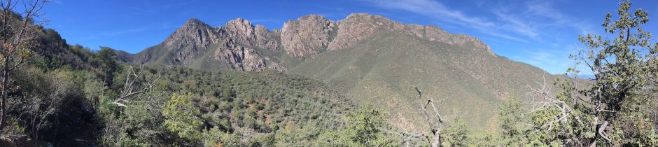
This hike we first, much like the previous hike, marched off to the west with the sights of  gorgeous Mexican vistas. Hiking past and around Parker Canyon Lake was pretty but uneventful apart from the constant hum of a border drone flying overhead…. Seriously…. The thing followed us for a good 5 miles. Connecting back to where we had just let off in the previous hike, we paused, bobbed our heads, about-face and shot back to the trailhead. Lunch at the Jeep with camp chairs is always a nice change. Now crossing the road and moving quickly into the Huachuca Mountains. The excitement of this leg was watching 5 border patrol Tahoes racing up and down the side of a far off ridgeline. Not sure if they were really chasing someone or just having a good time. The whole hike made us feel a little uneasy like being in a movie. Drone and Border Patrol agents all over the place. The final section of the hike starts to move into a more forested / tree green terrain and ended at Garden Canyon Road which appears to be another unpublicized AZT trailhead. From this spot, you would start the painful uphill hike to Miller Peak, from the backside. Let’s save that one for next year. 🙂


You must be logged in to post a comment.