 The Gila River Trailhead is a relatively short drive from Phoenix taking us only about an hour and a half to get to the exact place Eric and I left off over a year ago on Hike #13. This time to our surprise the little one lane bridge over the river was now being dwarfed by a new, still under construction, bridge towering beside it. Being a short drive, we actually got to the trail before the sunrise and there were bridge workers, trucks and spot lights all over the place. The white Tahoe comes in very handy sometimes since we typically blend in as another highway or government work vehicle. Parking on the side of the road and hiking down about a tenth of a mile to the trail connection point, Tom and I were quickly back on the AZT again. Since Hike #33, we decided to take a week off the trail and recharge our mental hiking batteries. Sometime I have noticed that without a break here and there, hiking every week tends to remove some of the uniqueness of each section. The trail all tends to look the same and without time off… you start to loose enjoyment of the hike’s beauty and only look forward to it being over with. Once you feel those thoughts popping up (too much), it’s time for a break.
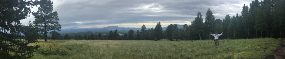
So this hike was planned as a 20 mile hike connecting Hike #13 back into the White  Canyon Wilderness south of Superior, Arizona. Most of the surrounding land is rough desert and there are many strip mines all around. The Gila River Canyon area being an exception of the landscape and to my surprise was an unknown oasis of water and lush trees. The whole hike was truly a pleasant surprise and I would recommend this one to anyone that just likes hiking. Even if you’re not doing the AZT, like the crazy two of us are. It is truly a unique hike that really needs more publicity as a great, “must do” Arizona hike.
The trail was well maintained and with a series of ups and downs snaking along the canyon sides and towering hundreds of feet above the river below, be prepared for amazing views. With occasional dips down to the canyon floor, the trail hike itself was I would say a moderate challenging shark tooth with constant elevation ups and downs. Along the river runs an old railroad track which in the 8 hours or so on-trail we did not see a single train. Not sure if it’s even used anymore but since we spent the entire day heading west with the tracks insight, my assumption is that the rails would eventually lead you into Florence Arizona.
 Making good time, pace and with fresh legs we pushed the hike out a little out past our planned turn-around to a total “out of back” of 21.5 miles. At the turn we broke lunch at a low spot close to the river’s edge and apart from the pests and bugs it was nice to enjoy the sounds of a river. In all my years in Arizona, I thought the Gila River was a dried up wash like everything else we call a river. It’s actually a real… like large, flowing river. Nice……The hike back was a little tougher then the out since… I should have known since the river was flowing in the direction of the hike out, that the way back would be a slight uphill, at least until mile 20 or so. All in all a another great day on the AZT and this hike was like a picture postcard. Something I wish everyone could see and experience.


You must be logged in to post a comment.