AZT Finished 05-30-2020

1600 miles (Out and Back)…. 3 years 9 months 28 days. 90 hikes. 🙂

Posted in Hikes, Tips & Tricks | Comments Off on AZT Finished 05-30-2020

So…. what now?

Hello fellow hikers,

Sitting here, 4 months after completing the 3 1/2 year “self imposed” journey of hiking the Arizona trail – northbound and southbound, I am trying to better understand how the venture has changed me and what I can share with you.

Although…… I am actually at a loss…..

Funny thing is, I am sitting in my same old chair at the exact same desk and computer that I did those 4 years ago while formulating this quest in my head. I feel odd….. much like returning from a war or coming out of fog. A fog of obsession I guess. But everything here is mostly the same. not changing much at all.

So, what have I learned and gained by hiking the AZT 1600 miles, 90 hikes – out and back?

For sure, I have changed. I have gained the love of long distance hiking and I also realize the blind power of focused determination. But I think most of all, what I have gained, is a warm and comfortable group of memories. Deep memories that I will have inside me for the rest of my life……… Which feels good. 🙂

Take care and happy hiking.

Jim T.

This is a silly selfie wall of the starting moment of all 90 hikes on the AZT. This is not a vanity thing…. It started out by accident and then it became a side mission to complete. Funny though to see how the AZT changes a person…. for the better. Loved the beard. 🙂

Posted in Tips & Tricks | Comments Off on So…. what now?

Hike #90 – Utah Border – The End – 21 miles

Location : Utah Border (NOBO Mile Marker 788.7 )

Date: 05-30-2020

Weather: Partial clouds skies, starting temperature 85 degrees, hot throughout the day with late afternoon showers.

Total Mileage Completed : 21 miles on AZT

Hike Description:   Hi All. So this was the final hike of the 3 1/2 year long goal of hiking the AZT in Out and Back Day-hikes. The previous hike was all the way back on 12-20-2019 before the COVID stuff and the 2020 income tax season at the office. May 30 being the first opportunity to knock this hike out and put a completion markers on the journey. I will compose another post later on with my thoughts on the entire endeavor. For now this Hike, Tom, Eric and I set out from Phoenix at around 3:45am back up the I17 all the way to the north rim of the Grand Canyon, taking House Rock Road off of highway 89A. We knew the day would be hot, even for Northern Arizona. The plan was to start at the AZ Border and hike out to Winter Road Trailhead (where we left off on Hike #75) and then double back for a dramatic completion at the northern terminus marker.

This hike is relativity flat with the exception of the 1200 foot ascent back up upon to the north Kaibab plateau. After this first 2.5 mile climb the trail levels off a little and you start to emerge in short pine and pinion pine trees. The day was hot and since we really had not done much hiking since December, man was it tough…. Funny how your conditioning goes away so quick and it’s like having to start all over again. We did this hike with an overnight in order to not have to make the long drive back to Phoenix late at night so we packed our bigger packs and rucked enough water for 2 days. The added weight and the climbs was punishing and by the time we got to Winter Road Trailhead, just 11 miles south, I was exhausted.

After a little break we started back toward Utah. The last turn a around of all the many out and back hikes….Just one footstep into the turnaround always made me feel as the majority of the day-hike was now behind us. 🙂 About 4 miles into the hike back we found a good spot and pitched camp for the night. A storm rolled in cooling everyone off and I got to enjoy one of the best moments of backpacking. Laying in the tent listening to raindrops fall. The next morning, typical coffee and snacks and off we went. That morning was cool with a slight breeze and the hike down the hill was simply amazing. One of those early morning hikes when everything felt perfect……A truly enjoyable completion to this journey.

Posted in Hikes, Hikes - Easy, North Kaibab | Comments Off on Hike #90 – Utah Border – The End – 21 miles

Hike #89 – Telegraph Road – South – 16 miles

Location : White Canyon Wilderness (NOBO Mile Marker 292.9)

Date: 12-12-2019

Weather: Clear skies, starting temperature 55 degrees, Cool throughout the day .

Total Mileage Completed : 16 miles on AZT plus approach trail of 10 miles

Hike Description:  This hike was located right in the center of the White Canyon Wilderness south of the I60 and a little west of Superior Arizona. Sandwiched between Hike #10 out of Picketpost TH and Hike #85, this is the most difficult section on the AZT to get to for a day hike. Hoping that Telegraph road would be doable with the 4×4 Jeep Wrangler, Tom and I set out early on a crisp December morning. After three failed attempts, in the dark, to get more than 1/4 of a mile down the road, we parked the Jeep and decided to just hike the approach, Adding 10 miles to the day….. The hike itself was really gorgeous, especially as we really got into white canyon. There is a way to get to the opposite end of the this section, but you would need to brave Battle Road from the east via Highway 117. Not particularly a tough hike but long day. If you can get back here, do it. Only one more hike to the finish.

Posted in Hikes - Moderate, White Canyon Mtns | Comments Off on Hike #89 – Telegraph Road – South – 16 miles

Hike #88 – Rogers Trough Trailhead – 22.5 Miles

Location : Rogers Trough Trailhead – Superstition Mountains (NOBO Mile Marker 319 )

Date: 12-12-2019

Weather: Partial clouds skies, starting temperature 38 degrees, Cold throughout the day

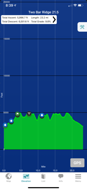
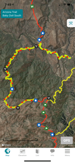
Total Mileage Completed : 22.5 miles on AZT

Hike Description:

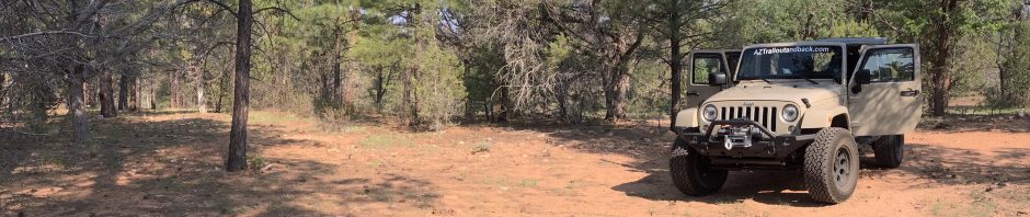
This hike was completed in December 2019, just after a week of pretty bad winter storms in Arizona. Compounded with that, this section of the AZT, running through the southern part of the Superstition Mountain, a couple months earlier had been ravaged by a brush fire. I knew it would be a rough trail but it was very very rough and nearly killed us…. So starting out very early in the morning, the turn off I60 and Queen Valley Road was easy to find, but that’s where the fun started. I know a lot of 4×4 guys will know this road up to Rogers Trough, but for us, in the dark, it was a bumpy long drive up some pretty steep hills with massive drop offs, especially towards the end and close to the trailhead. Note, its a good hour long drive from the highway to the Trailhead. A 4×4 with high clearance is for sure required, a steady steering hand also. 🙂

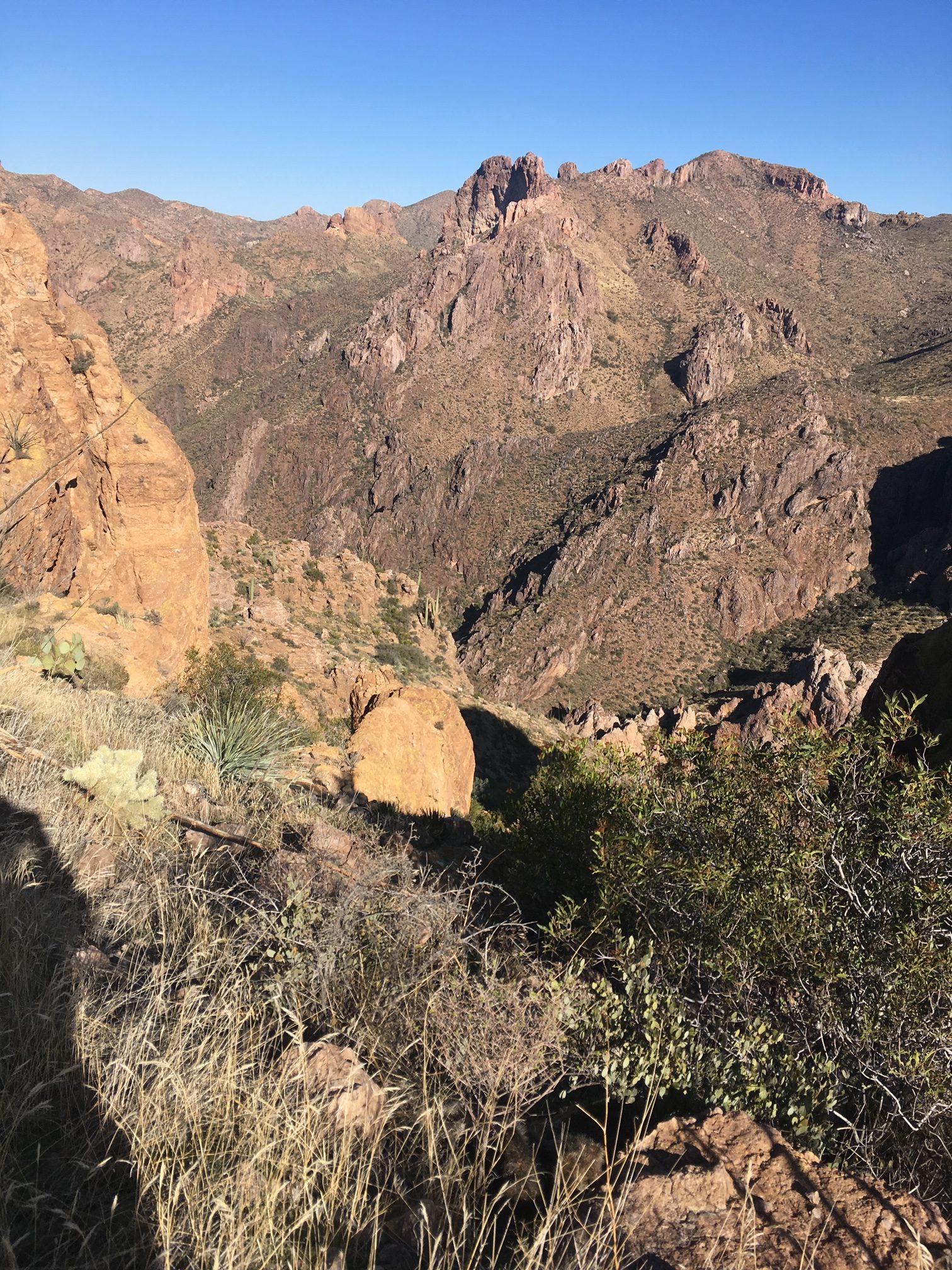
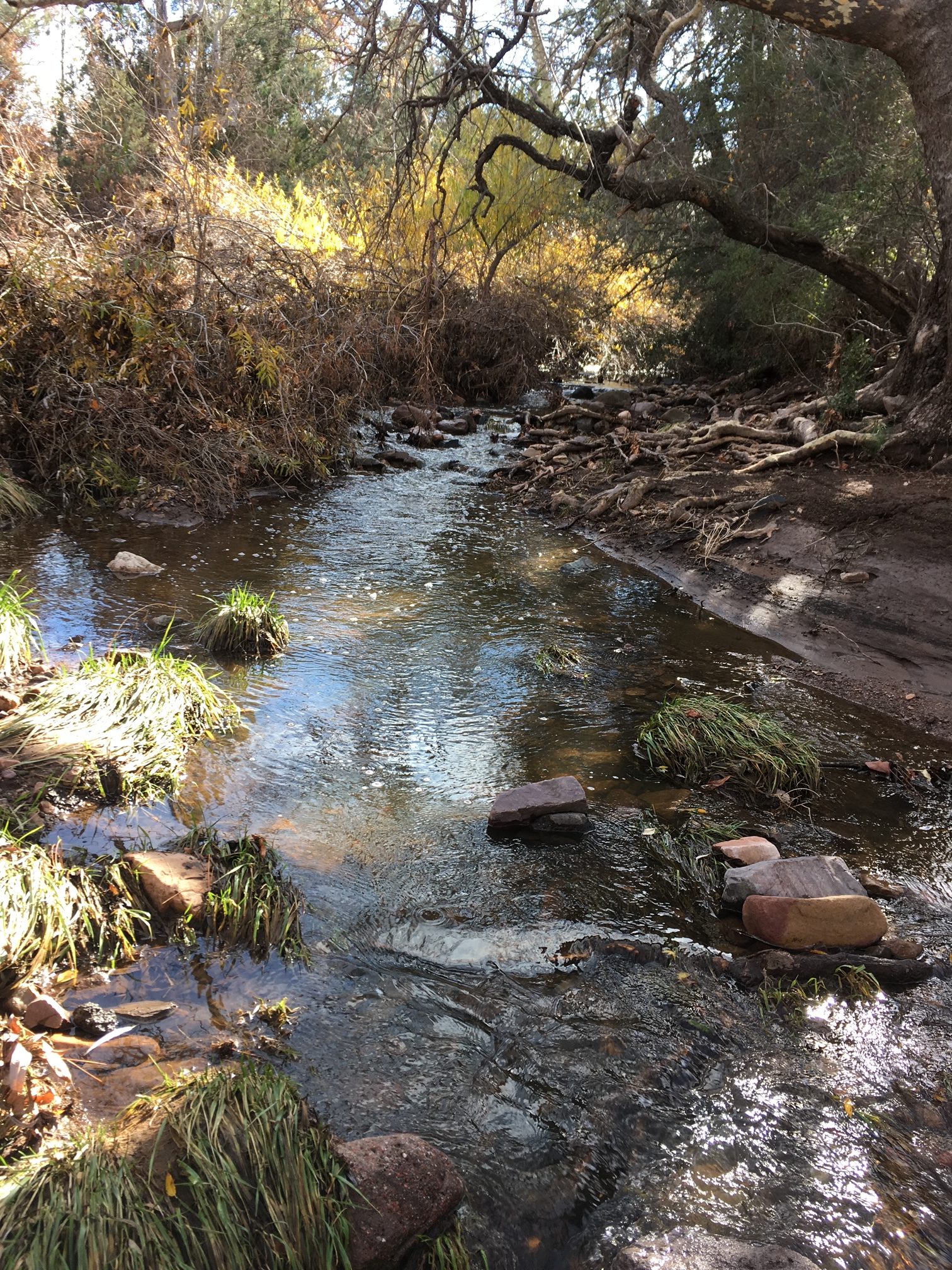
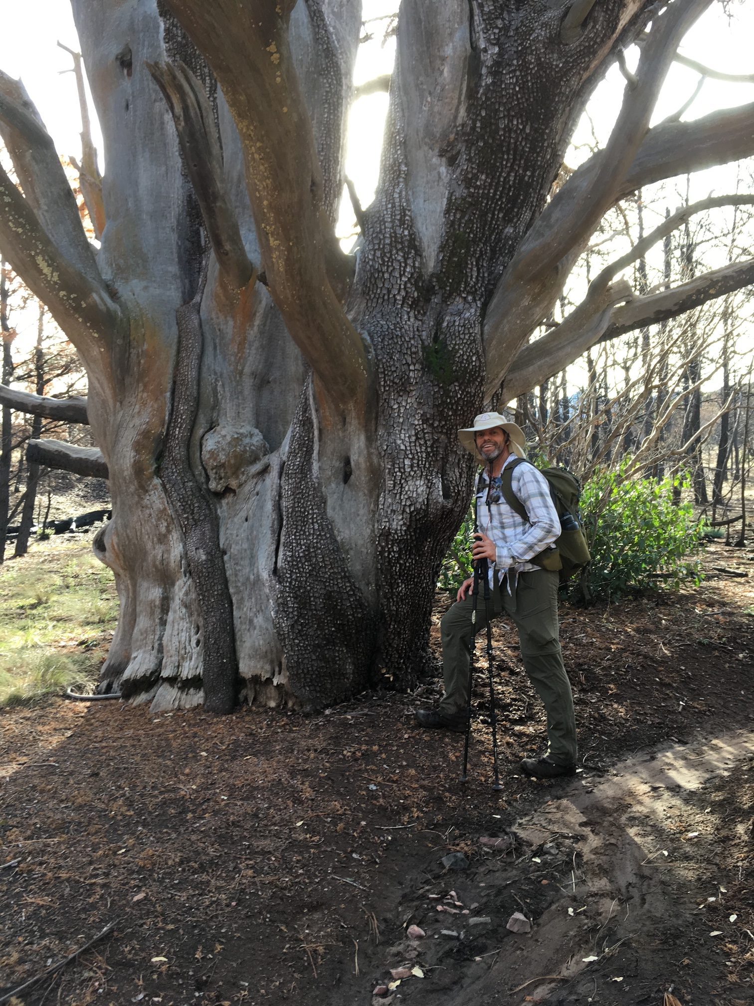
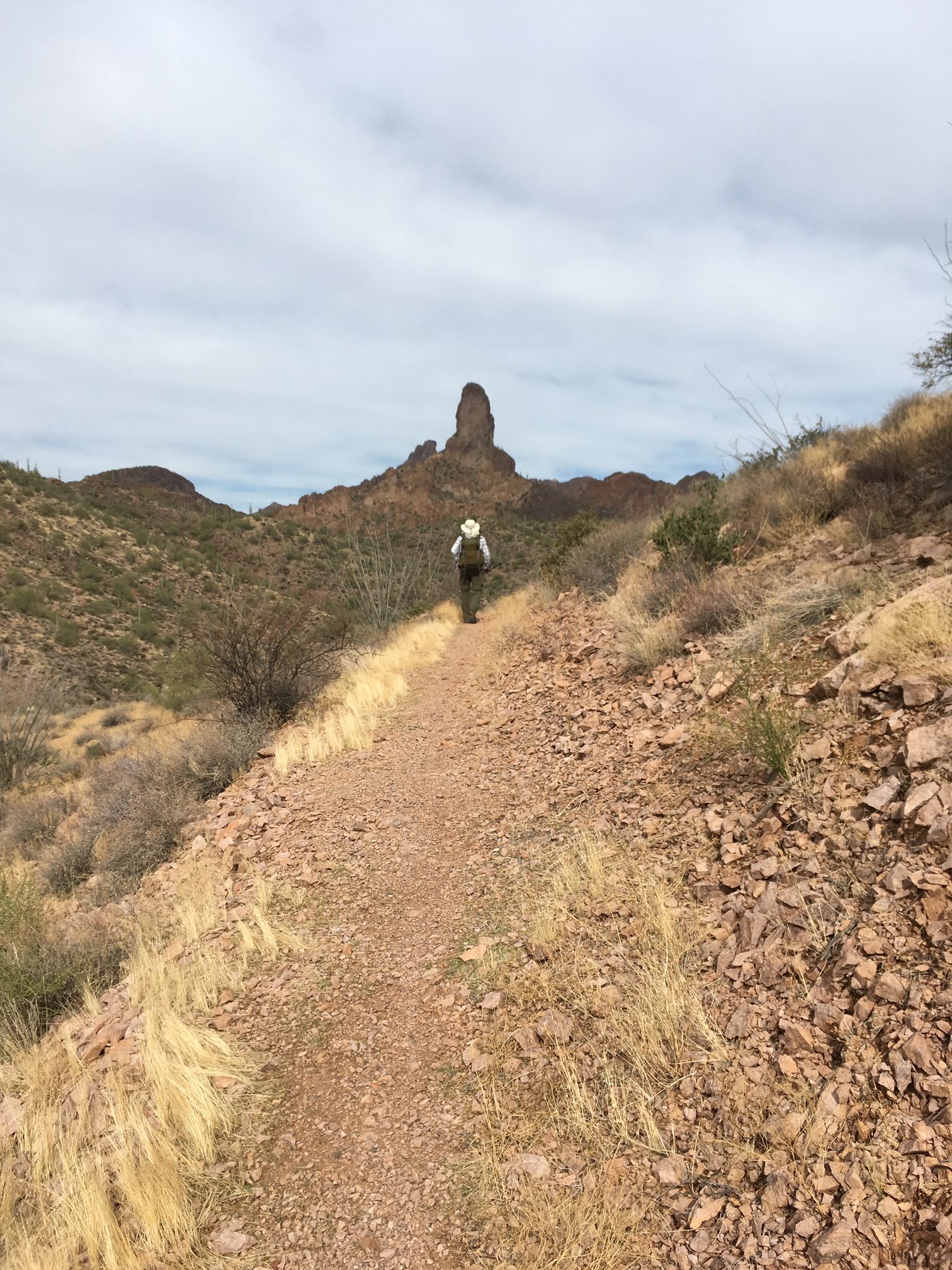
So…. the hike we knew was going to be tough and long 22 miles with nearly 4,000 feet of ups and downs. We just did not fully expect the condition of the trail would be so bad. The wash outs were insane and at one point of the mountain climb, the trail was completely washed out and we nearly fell 500 feet down a ravine trying to jump a washed-out switchback (NOBO 319.7). With the bad brush fire, most of all the really pretty scenery was burn and ugly. There was some part of this section the awesome wild-land fire crews had been able to protect near Reavis Pass. Great job guys. Thank you. I truly could not imagine the work they had to endure to hike into this area and fire the raging fires.

All in all a good tough hike but not one I would redo for fun…..

Posted in Hikes - Hard, Superstition Mtns | Comments Off on Hike #88 – Rogers Trough Trailhead – 22.5 Miles

Hike #87 – Bloodsucker Wash – 19.9 Miles

Location : Bloodsucker Wash – Freeman Road (NOBO Mile Marker 223.5 )

Date: 12-07-2019

Weather: Partial clouds skies, starting temperature 59 degrees, Cool to Warm throughout the day

Total Mileage Completed : 19.9 miles on AZT

Hike Description:

This hike was a nice little hike with a little elevation up and down of 3,016. Kind of a rolling hill hike and apart from the difficulty getting to the trail intercept, it was actually a very enjoyable hike. Driving out south of Florance Arizona and back on Freeman road, this time you veer south on Willow Spring Road. You might want to map this one since it’s a bit of a hard drive to get out to Bloodsucker wash and a 4×4 is pretty much required. Scratched up the Jeep quite a bit driving down the wash. Becareful of flash floods if there are storms coming.

Anyhow the hike itself was, as noted, pretty enjoyable. We had to flip flop a little to connect Hike #15 from Tiger Mine TH and Hike #49 from Freeman Road TH. Don’t try this in the summer for hot months. Funny thing is we ran into a whole group of trailrunners that a bus dropped off at Bloodsucker wash. They were running to Tiger Mine and I really have no idea how that Bus got out in the middle of the desert. Good for them…. was an interesting site to see, a stream of trail runners just jogging out in the middle of nowhere.

One more hike down. Love the AZT. 🙂

Posted in Hikes - Easy, Oracle | Comments Off on Hike #87 – Bloodsucker Wash – 19.9 Miles

Hike #86 – Two Bar Ridge – 22.1 Miles

Location : Two Bar Ridge up Forest Road 83 (NOBO Mile Marker 339.2)

Date: 12-05-2019

Weather: Slightly cloudy skies, starting temperature 58 degrees, Cool throughout the day

Total Mileage Completed : 22.1 miles on AZT

Hike Description:

This hike was simply gorgeous and to be honest, not too hard to get to from Highway 188 just south of Roosevelt Lake. Forrest Road 83 is a doable dirt road that runs up a wash and only becomes challenging in the last mile or so toward the intercept of the AZT. If anything drive as far as you can and hike the approach. It’s really not too far.

The hike itself I have labeled as extreme as the distance of our day was 22 miles and the up and down elevation gain / loss was 5837, one of the highest on our schedule. The day was cool and the ground was still wet from a storm that rolled through the are the night before. The views thought from this section are well worth the pain of the hike. I mean… look at these photos…. In retrospect I don’t recall the hike being too difficult considering the elevations. It was much more of a rolling grade or up than down than up. Toward the turn at mile 10 there was a massive up climb that had been affected by the summer brush fire. That sections was a wasteland and without any vegetation, the climb up and down in that section was pretty dangerous. Dig in with the trekking pulls and push….

All in all a great day and this hike I would do again. Great views!!!!

Posted in Hikes - Extreme, Superstition Mtns | Comments Off on Hike #86 – Two Bar Ridge – 22.1 Miles

Hike #85 – White Canyon / Aqua Fria River – 18 miles

Location : White Canyon Wilderness (NOBO Mile Marker 273.1)

Date: 11-25-2019

Weather: Clear skies, starting temperature 59 degrees, Cool throughout the day .

Total Mileage Completed : 18 miles on AZT plus approach trail of 8 miles

Hike Description:

This hike was a tough approach trail and in retrospect was a little poor planning on my part. For years I had studied the maps trying to figure out how to get back to the elbow of the AZT in the White Canyon Wilderness along the Aqua Fria river. The eastern part was so easy we did it way back on 12-20-2016 (Hike #12). I knew this hike and the upcoming Hike #89 would be a big approach trail and long AZT miles. I found Battle Axe road off of Highway 177 a very popular 4×4 road entrance into this section and with a little googling, I found a way to get just north of the AZT from what appears to be a small bushwhacking wash hike of like 1 mile to a road that would eventually lead back to the AZT at mile marker NOBO 273.1. This simple little wash turned out to be a scramble that we had to do twice… and the approach road was long long long than a wash hike in soft sand for about 1 mile to finally reach the AZT. Once on trail, man it was easy flat quick hiking.

It was a nice cool day and this AZT part of the trail only offered a challenging up and down when you reach the elbow of the trail entering White Canyon, which is were I found a nice looking AZT Trailhead sign and parking lot… I guess if you would have continued on to this offshoot of Battle Axe road you would eventually ended up here. Now I have no idea how bad the road is as we obviously did not take it that far, but it must be good enough for the AZT people to truck a big metal trailhead sign out here. Maybe save yourself the goofy approach trail stuff and try it. This TH is at mile marker NOBO 279.3.

After the sign we hiked into the White Canyon from the south and the views became amazing. The white canyon has to be the most remote section of the AZT but it’s worth the trouble. Very cool area of Arizona.

Posted in Hikes - Moderate, White Canyon Mtns | Comments Off on Hike #85 – White Canyon / Aqua Fria River – 18 miles

Hike #84 – LR Ranch / Baby Doll TH – 26 miles

Location : Baby Doll TH – Outside Payson AZ (NOBO Mile Marker 438.3 )

Date: 11-17-2019

Weather: Clear skies, starting temperature 60 degrees, cool throughout the day.

Total Mileage Completed : 18.2 miles on AT – 7.1 miles approach trail

Hike Description: 

This hikes was truly the hardest hike in our AZT “Out and Back” series. Prepare yourself for this one. It’s long and an uphill battle pretty much throughout the day. The two largest issues in doing the AZT in day hikes are… #1 big hikes are tough. Without daily monster mile hiking, your legs, even at your best, are just not conditioned enough for a 26 plus mile, 6200 feet elevation gain hike. Now Tom and I had been hiking a lot when we took on this monster. We had completed all the other Matazal wilderness hikes plus the Rincons but man this one was tough…. Oh and #2, day-hiking big hikes, there is always the pressure of time and speed. Like we have keep going to get back to the car and home.

This hike starts out at the Baby Doll trail head, an easy drive from Highway 87 and Payson’s Main Street. We had done this approach trail before way back on Hike #32 (10-24-2017) and I can recall saying… god help us when we have to come back and go southbound. so…… two year later……It did not disappoint and not to bore you with the details, I had to push myself past my physical limitations. Nice views though and easy clear trail to follow. 🙂

Posted in Hikes - Extreme, Mazatzal Mtns | Comments Off on Hike #84 – LR Ranch / Baby Doll TH – 26 miles

Hike #83 – City Trailhead – 13.1 Miles (24.6 total)

Location : City Trailhead – Payson AZ (NOBO Mile Marker 427.6 )

Date: 11-07-2019

Weather: Slightly cloudy skies, starting temperature 65 degrees, Cool throughout the day.

Total Mileage Completed : 13.1 miles on AZT 11.5 miles on the approach trail (24.6 Total Miles)

Hike Description: 

This hike started at the City Trailhead very close to the Baby Doll Trailhead east of Payson. Tom and I messed up a little right off the bat veering left after we went thru the gate at the trailhead. You have to go across the creek bed and the trail is easy to follow moving toward the south. We took a cow trail next to the opening of the gate and bushwacked it for a mile like dummies…. Alltrails app helped us get back….

Anyhow the approach trail is a tough climb and…. take a look at the new AZT Guthooks trail app….. all the possible AZT approach trails are now included. When we did this hike, those were not there. Either-way prepare yourself for a good uphill climb for about 5.5 miles. Fortunately the trail is wide and smooth, so it was easy going. Once on the AZT (NOBO Mile Marker 427.6), we hiked south to get back to Rocky Ridge (NOBO 422.2) and the spot we left off on Hike #79. Getting back to Rocky Ridge was a tough little climb at the turn but we made it. Nice lunch spot with views.. as far as the eyes could see looking toward Flagstaff. Simply amazing actually. Worth the effort. Heading back we had to overshoot the connection trail and head down a couple miles in an effort to flip flop and cut our future Hike #84’s miles down. This section took us to a second turn around at mile marker 428.7 and a creek called “Seeps” Tough little climb back up and smooth fast pace downhill on the approach trail back to the Jeep. Nothing is better than constant smooth downhill after climbing all day. The AZT and the approach trail turned out to be a 5,748 feet up / down elevation day. One of the steepest in our AZT venture. One really good thing, was the trail was smooth, not a lot of rocks at all. Nice…. 🙂

Posted in Hikes - Hard, Mazatzal Mtns | Comments Off on Hike #83 – City Trailhead – 13.1 Miles (24.6 total)