 Hi all,
So remember Hike #35- Miller Peak, the hike from the Mexican Border to the Peak and back? Well… this hike was almost identical…… but a little harder and longer. Back in 2016, Eric and I ended up cutting Hike #14 a little short (due to a late start) of our goal – Mills Ridge Trailhead coming out of Roosevelt lake and the Vineyard Trailhead mile #348 NOBO. Therefore, Tom and I had to do a little “flip flop” in this hike, first hiking down about 1.2 miles to connect the trail and then pushing up into the Four Peak Wilderness.
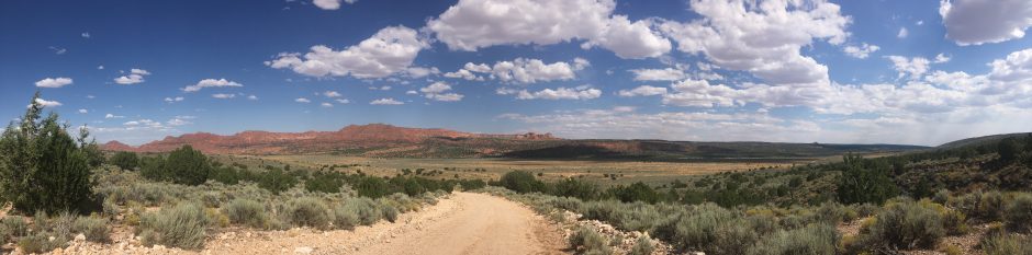
The hike started out early on May 1st, 2018, with the temperature being somewhat unseasonably cold for the month of May. Driving from Phoenix north on the Highway 87 and turning onto Highway 188, reversing our way to find Mill’s Ridge road right before Roosevelt lake. I do need to warn you, Mill’s Ridge road is a little aggressive and it was a good thing we had the AZ Trail Jeep, 4 wheel low was nearly a requirement getting to the trailhead. The name of the road was very fitting, it’s really a ridgeline road. So…. once at Mills Ridge Trailhead, you will truly be in awe of the 360 degree views…. just amazing and a crazy thought that you just drove to this location. Really a  flattop on the peak of a mountain, towering far above the lake below.
As I mentioned before, Tom and I took a quick 1.2 mile SOBO hike, about 458 feet downhill until we accomplished the flip flop and then began the long climb to the turn. This hike was definitely a “hard” hike with nearly a 4000 foot climb from bottom to turn. Up up up was the thought for the day. Coming out of Hike #41’s poor performance I was slightly concerned about my survival. Although with the weather, nearly 30 degrees cooler from last week, my fears quickly faded and the clouds and cool breezes made the hike very much enjoyable. Don’t get me wrong, the climbs were tough but with a couple breaks and the trail designers addition of a flat here and there, I  approached the turn with good spirts and legs. Tom always seems to take the ups with ease.
Lunch and a couple photo’s of Four Peaks, and back down we went. In all honestly, the down hill was actually much worse than the up…. It just would not end…. Check out the elevation chart on this one, toe crunching all the way. In my mind, it was very, very close to the Miller Peak hike. Up Up Up and than Down Down Down. Please note though, this hike did have many more dangerous “shelf” like drop offs, especially around mile 13-14 coming back to the trailhead. Be very careful, no rails on this trail. 🙂
All in all, a great hike with awesome views and a real accomplishment. Good confidence builder…. The hiking legs are back !!! Now on to the next AZT “out and back” section.


You must be logged in to post a comment.